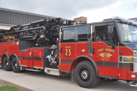
Staying alert
Severe Weather Awareness Week starts today
-
-
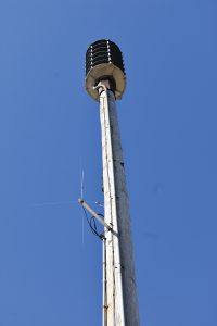
-Messenger photo by Chad Thompson
A tornado siren near City Hall is pictured here. There are six sirens that sound from it.
-

-
-Messenger photo by Chad Thompson
Dylan Hagen, Webster County emergency management coordinator, stands next to the tornado siren in the area of the Fort Dodge Municipal Building. This week is Severe Weather Awareness Week.
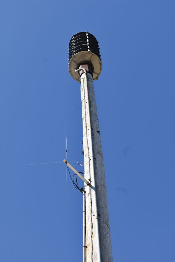
-Messenger photo by Chad Thompson
A tornado siren near City Hall is pictured here. There are six sirens that sound from it.
Severe thunderstorms or violent tornadoes can strike anywhere at any time in Iowa. And when storms strike, people can lose their homes or their lives.
That’s why Dylan Hagen, Webster County emergency management coordinator, is emphasizing preparedness and alertness when it comes to severe weather.
Severe Weather Awareness Week begins today.
To stay tuned in to what’s happening in the skies, Hagen recommends having multiple ways to receive weather alerts.
“Ensuring that folks have more than one way to receive notification about severe weather,” Hagen said. “Some of those would be your weather radios, Webster Alerts (which are free for the public to sign up for through Alert Iowa), several apps on your phone, outdoor warning sirens, local news and radio and social media.”

-Messenger photo by Chad Thompson
Dylan Hagen, Webster County emergency management coordinator, stands next to the tornado siren in the area of the Fort Dodge Municipal Building. This week is Severe Weather Awareness Week.
Hagen said the outdoor warning sirens aren’t necessarily meant to be heard inside.
To practice weather safety, Webster County will activate the tornado sirens at 11 a.m. on Wednesday.
“We encourage all businesses, schools and offices to participate in the tornado drill on Wednesday,” Hagen said.
The sirens will be activated countywide for three minutes.
The county uses WeatherWarn to monitor and activate sirens.
Hagen said when a real warning is issued, the sirens are activated through that web-based program.
“As soon as the Weather Service issues that — the dispatcher no longer has to physically activate the sirens,” Hagen said. “However, we can manually activate them if needed. But that’s instantaneous from the Weather Service. Oftentimes, it will go off before the phones even do. It’s a very good system.”
Callender, Dayton and Harcourt are the only communities not on the new system.
“Their sirens are not compatible with the system,” Hagen said. “We are working with Dayton, Callender and Harcourt to upgrade their sirens. That way everyone in the county is on the same system.”
When the sirens do sound, it is for a specific area.
About two years ago, when the county began using WeatherWarn, it started activating sirens for only the tornado-warned area and not the entire county.
“If Harcourt is in a tornado warning, the sirens in Clare do not go off,” Hagen said.
Hagen said the county is considering sounding the sirens for more than just tornadoes.
“We only activate sirens for tornado warnings but counties are looking at changing their activation policies for wind like the derecho,” Hagen said. “That’s been a conversation to activate the siren for wind.”
Iowa was hit hard in August 2020 by a derecho. The storm left widespread damage comparable to damage that can be left by tornadoes.
In addition to following alerts and hearing sirens, Hagen said having a safety kit is important.
“Having a safety kit, first aid kit, blankets, water, flashlights, batteries,” he said. “Have a plan and know where to go when severe weather happens. At home, at work, out shopping or out to eat. It can happen anytime, anywhere, so you always have to be prepared.”
Typically, Webster County will offer a storm spotter class during the year. Hagen said one won’t be offered locally this year.
Instead, the Weather Service is hosting online courses. To register, visit weather.gov/dmx
The next class is Wednesday at 1 p.m. An advanced class will be offered April 19 at 7 p.m.
Each day this week, the Webster County emergency management Facebook page will post about a different topic.
Today, Hagen will post about severe thunderstorms.
“Knowing the difference between a watch and a warning,” he said. “Knowing the different types of severe thunderstorms or what classifies as a thunderstorm.”
Hagen said a watch is more widespread.
“Just be aware that there is a potential for the threat of severe weather to occur,” Hagen said.
A warning, on the other hand, is a more defined location and a confirmed severe thunderstorm that meets the criteria.
Hail 1 inch or greater, winds in excess of 57 mph or a tornado qualifies as a severe thunderstorm.
Tuesday, Hagen will share information about warning reception. Wednesday he will post about tornadoes.
Thursday is preparedness and Friday is about flooding.
“If the road is closed due to flooding, don’t drive around barricades,” he said. “You don’t know if the water has washed away part of the road.”
When it comes to the weather, Hagen said the most important thing is to stay aware.
“Just be weather aware,” he said. “Things can change very quickly. It’s always important to have those alerts to your cell phone. Just be weather aware.”